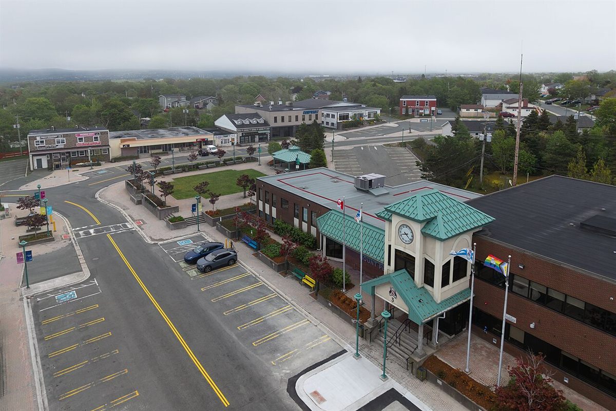
Mount Pearl at a glance
- Origins: Mount Pearl takes its name from Sir James Pearl, who was granted land here in 1829. It grew from summer cottages and the Glendale subdivision.
- Town and city: it was incorporated as a town in 1955 and became a city in 1988 — the third in the province.
- Boundaries: Southlands was once part of Mount Pearl, but the province moved it into St. John’s in 1991.
Neighbourhoods at a glance
Mount Pearl Park and Glendale
The original core of the city, around Park Avenue, Commonwealth Avenue and Glendale Avenue, with the oldest homes in Mount Pearl. City Hall and Centennial Square are here, and the City has a long-term plan to renew the city centre around St. David’s Park and the Waterford River.
Newtown
A residential area in the south of the city, added in the early 1980s, with Newtown Elementary.
Power’s Pond, Parson’s Meadow and Admiralty Wood
The south end, where most of Mount Pearl’s residential growth has happened since the late 1980s. Power’s Pond is the centre of it, with a boat house, an off-leash dog park and trails.
North of Topsail Road
Kenmount Park, Pearlview, Brookhaven, Mount Carson Terrace and Masonic Park are established residential areas between Topsail Road and Kenmount Road. Further up, Kenmount Hill is the city’s newest growth area.
Business and shopping areas
Commonwealth Avenue is the main commercial street. Pearlgate has big-box retail, and Donovans Business Park, south of Topsail Road, is a major employment area. Southlands, just south of Mount Pearl, is part of St. John’s.
Schools
Mount Pearl has eight English public schools:
- Primary and elementary: Mary Queen of the World, Morris Academy, St. Peter’s Primary and Newtown Elementary.
- Intermediate and junior high: Mount Pearl Intermediate and St. Peter’s Junior High.
- High school: Mount Pearl Senior High and O’Donel High. Mount Pearl Senior High also serves many Paradise students.
- French Immersion: available on paths through St. Peter’s Primary, Newtown Elementary, St. Peter’s Junior High and O’Donel, and through Mount Pearl Intermediate and Mount Pearl Senior High.
- French first-language schools: the nearest are the CSFP’s two schools in St. John’s.
Always check the zoned school for the exact address. Our school zones guide shows how.
Getting around
Topsail Road runs east–west through the city, and Commonwealth Avenue, Ruth Avenue and Mount Carson Avenue are the main north–south roads. The Team Gushue Highway links Topsail Road and the Commonwealth Avenue area to Pitts Memorial Drive, the fast route downtown.
Driving times from City Hall, outside rush hour (estimates):
| To | Distance | Time |
|---|---|---|
| Health Sciences Centre | 10 km | about 13 min |
| Downtown St. John’s (Water Street) | 13 km | about 13 min |
| St. John’s International Airport | 17 km | about 20 min |
Estimated with OpenStreetMap routing. Expect longer at rush hour.
Bus: Metrobus routes connect Mount Pearl with the Village Shopping Centre in St. John’s, where you can transfer to other routes. Check Metrobus for current routes and times.
Recreation and the outdoors
- Summit Centre on Smallwood Drive: the City’s pools and fitness centre, with the Reid Community Centre.
- Glacier Arena on Olympic Drive, a venue for the 2025 Canada Games.
- Power’s Pond: a boat house, an off-leash dog park, and seasonal canoe, kayak, ski and snowshoe programs.
- Trails: about 60 km of walking trails, including the Grand Concourse trail along the Waterford River.
- Parks and sports: St. David’s Park, with a nature playground and walking track, plus the Pearlgate track, a tennis complex, the Team Gushue Sports Complex and its skatepark, and many fields.
- Admiralty House Communications Museum: in a wireless station built by Marconi in 1914 for the Royal Navy.
- Frosty Festival: Mount Pearl’s winter festival every February, running for more than 40 years.
City services and rules to know
Property tax
Property tax and water and sewer fees are set each year in the City’s budget. See this year’s rates, and how they compare with neighbouring towns, in our property tax by town guide, or try the property tax calculator. The City also offers tax relief for some seniors and low-income owners — check the City’s website for who qualifies.
Garbage and recycling
Garbage is collected weekly from a City-supplied cart, and recycling goes out in blue bags beside it. Each street has a set collection day. Check the City’s garbage and recycling page for your day and the current rules.
Snow
Mount Pearl has a winter overnight parking ban on city streets, plus no parking during a storm or for several hours after one. Check the City’s snow clearing page for this year’s dates. Sidewalks near schools are cleared first. You can’t push snow onto the street or sidewalk, and there’s an online plow tracker.
Permits and planning
- Permit guides: the City publishes guides for decks and patios, sheds, exterior renovations, pools and basement apartments. Applications are filed online.
- Basement apartments: they need a building permit, plus plumbing and electrical permits, and an occupancy permit before anyone moves in.
- Zoning: the City is updating its municipal plan, so check the zoning of any property you’re considering.
See our two-apartment homes guide for what else to check.
Health care
The nearest hospitals are in St. John’s: the Health Sciences Centre (with the Janeway children’s hospital) and St. Clare’s Mercy Hospital, both with emergency departments. NL Health Services runs several clinics at 850 Topsail Road in Mount Pearl. Check NL Health Services for current services and hours. If you need a family doctor or nurse practitioner, register with Patient Connect NL, and call 811 for health advice.